Can you find the BEAR?

Someone had set up 2 tents along the Appalachian Trail inside the borders of the Great Smokey Mountain National Park between Ice Water Springs Shelter and Newfound Gap, a violation of park rules.  Campsites along the AT in the park are limited to the shelters to concentrate hiker impact to as small an area as possible.  After setting them up, the bad apples then decided to leave the tents unattended.  As I hiked by, this bear was deciding to take matters into his own paws, and was at work tearing the tents apart to get whatever was inside.  From about 50 feet away, I snapped a few pictures, and left him to go about his business.

small bear
can you find the bear in this picture?
A little closer, but not too close. The bear was much more interested in the tent than me.

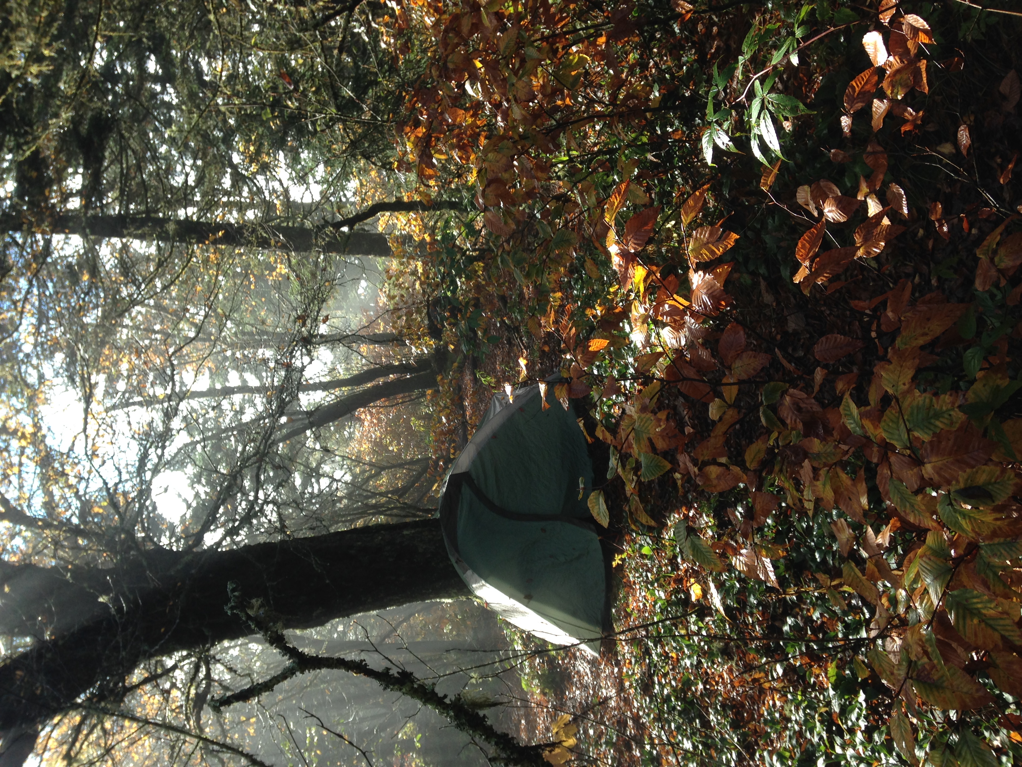
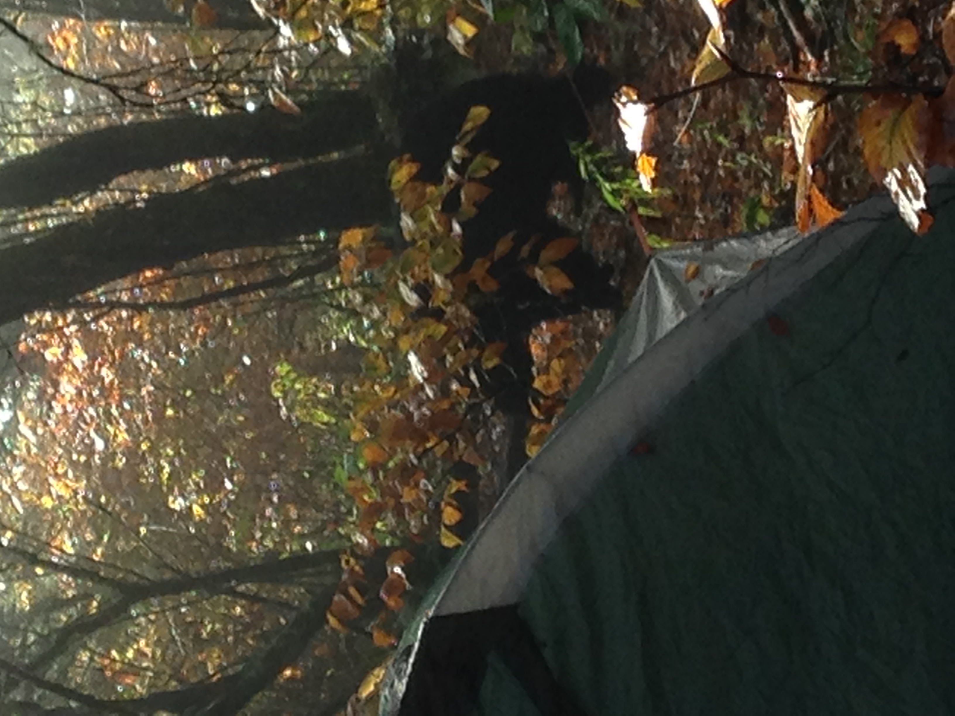
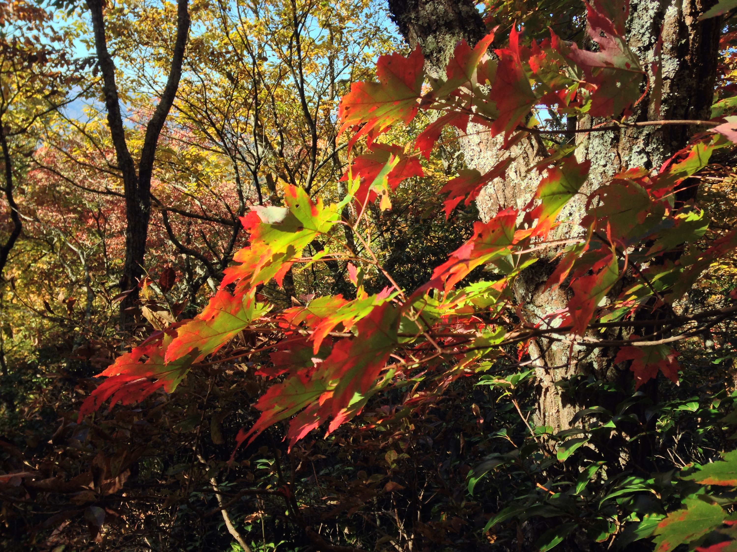
Photos taken October 11, 2015.

End of the trail

Stover Creek Shelter to Springer Mountain, Southern Terminus of the AT, to Benton MacKeye Trail (BMT) Loop 2.8+5 miles.

.

I popped up early, and was on the trail by 9:00 for my last day of hiking, somewhat sad that this part of the adventure was ending.  I met Wayne, my Georgia Sherpa, at the Forest Service Parking Area for the climb up Springer Mountain.  It was only 1.9 miles from the shelter, so I had plenty of time to get there and take some pictures of my boots.  The Merrell Moab Ventilators held up well.  They even have a few more miles left in them.  The only thing I don’t like about them is they take 2 full days to dry once they get saturated.

The sun greeted us for my final day, and Wayne joined me for the trip up Springer, then a little extra on the BMT for fun.  I emptied my back for my first slack packing of the trip.  It was kind of nice to hike with only about 10 pounds of gear.


The first, or last blaze, depending on your direction.

Logging in on the Springer Mountain Log book next to the plaque.

Maybe not the best view, but a nice view…We had lunch at an overlook of the BMT.  Wayne was nice enough to bring turkey sandwiches, chips, and apples.  Fresh, un-squished bread makes all the difference to a hiker.

Happy trails to you, till we meet again

Hawk Mountain Shelter to Stover Creek Shelter. 5.3 miles. 2.8 miles to go.

After a promise of sun today, I left the shelter in a drizzle. By 10:00 the rain stopped, but no sun.

For the first time, the trail for the last 5 miles has been wide and flat, like a paved road. I did follow a stream that was really flowing after the rain.  Long Creek Falls was spectacular.

Made it to the shelter by 12:30. This is a really nice shelter for my last night on the trail.  I set up my hammock for an afternoon nap, and the sun is wanting to come through,  as the sky turns blue.

I meet my Georgia Sherpa, Wayne, at the bottom of Springer Mountain between 10 and 11 tomorrow for the final 2 miles to the Southern Terminus of the AT.

I’m proud that I accomplished my goal of 300 miles, but sad that my time on the trail is ending.

Soggy

Gooch Mountain Shelter to Hawk Mountain Shelter. 7.7 miles + 2.8 miles.  8.1 to go. 

  
Had lots of rain all night, continued to rain all morning.  Not a problem though, I didn’t have far to go, except that for the first time, I went the wrong way on the trail, and had to backtrack for an extra 2.8 miles. 

Around 3:00 the rain finally stopped, the sun started peaking out, and the skies turned blue. 

Tomorrow is my last full day on the trail.  The sun should be out for a great end to the trip.  Loving my adventure. 

Blaim it on the Rain

Neels Gap to Woods Hole Shelter.  3.5 miles. 28.2 to go. 

After a couple weeks of perfect weather, the rain came back.  I didn’t have far to go today, so I was able to take a lesurly start out of Neels Gap to climb Blood Mountain.    Other than being slippery, it was not a hard climb.   

 We are supposed to get rain again tomorrow before it clears up, and I have a long day, so I’ll try to start early.   So far, I have a really nice shelter all to myself. I was able to get in early enough to take a nap, and I just watched a movie I downloaded to my phone at the hostel. 

Time to wrap up in my sleeping bag and enjoy the sound of the rain on the roof of the shelter. 

A Walk through the Clouds

Woods Hole Shelter to Gooch Mountain Shelter. 12.3 miles. 15.8 to   go. 

 I woke up and didn’t want to leave my bag.  The clouds had settled in and I contemplated staying put for the day.  I decided to embrace the trail the way it is today and headed out into foggy, cool, rainy day. 

This was my last 10+ mile day. The trail is shrinking.   The section I’m on now is the section that all the NOBOs start their treks.   I can feel all the bootsteps that proceeded me. 

I’m spending the night in a nice shelter in the upstairs loft. Lots of section hikers just starting short trips north.  Looks like we have 1 more day of rain before I finish with some sun. 

On gear news, my waist belt broke this afternoon, I’ll have to try to rig something tomorrow. I’ve only got 7.7 miles tomorrow, so I don’t need to get out early. 

Mountain Crossing/Crossing Mountains

Whitley Gap Shelter to Neel Gap. 7.9 miles.  31.7 miles to go.

Had a great night at the shelter. Started a fire and had cell service so I was able to call home and talk with the girls.

Woke up, ate breakfast, then fell back asleep for an hour since I didn’t have too far to go today.

Had cool weather and a little sun for the afternoon.  Made it to Neels Gap at 4:00.   The trail goes right through the outfitter/hostel.  This is the only spot the AT goes through a building.

I climb 1350 feet up Blood Mountain in the morning.   Looking forward to some good views.

50 for 50

Unicoi Gap to Whitley Gap Shelter. 15.7 miles.

I’m one of those people. I finally weighed my pack at the hostel before I left for the trail. With 3L water and 6 days of food, my pack weighed 50 lbs. I thought it was 35…since I’ve carried it over 200 miles, I guess it is OK.


Breakfast at the hostel, then a ride to the trail.  No blue skies, but no rain either. Made it to my destination shelter at 2:30, and decided to go one more. Made it to new shelter at 6:00 for my longest day yet.

Shelter was empty, so I gathered wood for a fire and cooked dinner as the sun set.  Great night.

Leavin’ on a midnight train to Georgia on my mind

Muskrat Creek Shelter to Top of Georgia Hostel via Dicks Gap. 11.8 miles.

North Carolina – Georgia border


Woke up early and hit the trail at 8:00 with my new friend Megan, the California engineer.  It took me 21 days to find a SOBO that hikes at my pace.

Made it to the Georgia border and the Chatahoochee National Forest, I’m just not sure what those muddy waters meant to me.

Made it to Dicks Gap and checked into a really nice hostel by 3:00. Relaxing the afternoon away.